Of all of Canada’s nearly 10 000 000 square kilometres, Fish Point Nature Reserve, home to salamanders, cacti, and sycamores, south of Rome and Barcelona, is one of the most unique.
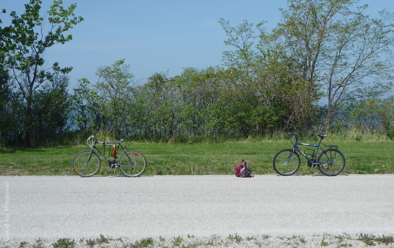
- Transit: On Pelee Island we enjoyed biking, though most people got about by car. To get to Pelee Island you have to take a ferry.
- Cost: Fish Point Conservation Area is free. Getting to Pelee Island is not.
- Crowds: Some island attractions were busy; Fish Point was pretty quiet on a long weekend Sunday morning.
- Attractions: Hiking, photography, bird watching, beaches, lots of flora and fauna that are rare, or not found at all, anywhere else in Canada.
- Accessibility: Getting to Pelee Island from the GTA is one of those trips that doesn’t look long on a map, but reminds you of how goddamn big Canada is when you finally take it. Fish Point itself is pretty flat. The trails are all dirt and beach.
- Click here for map
It’s a sunny late-May day. It’s 24 degrees, there’s a cool lake breeze, and the sun is hot. We’ve come to Pelee Island, the southernmost* place in Canada for a long-weekend getaway.
(*There’s a small conservation area, Middle Island, just south of here that’s the absolute southernmost point of Canada. If anyone’s listening who can arrange it, I’d love to check it out sometime.)
Pelee Island is a large limestone flat in the middle of Lake Erie. It’s like a sleepy seaside cottage community around the coast, with farms and vineyards in the interior.
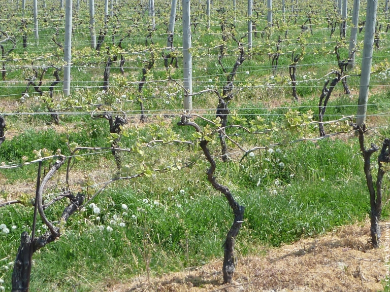
We bike past Canada’s southernmost winery on our way that morning. Every other attraction on the island boasts itself “Canada’s southernmost.”
Quiet, flat roads. Warm sun. Lake breezes. This island feels made for cycling.
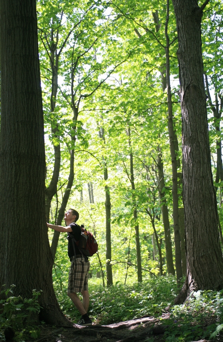
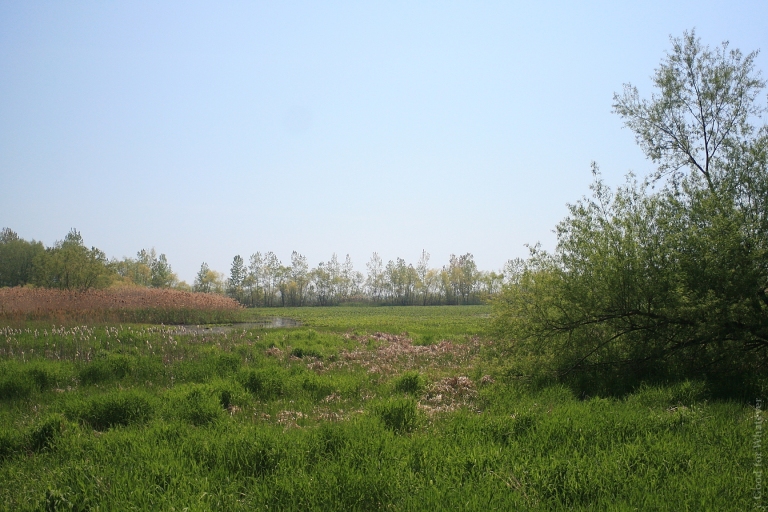
Shortly the way veers from the coast and we go headlong into Fish Point Conservation Area, the very bottom of the island, a wall of green to one side of us and the lake to the other. Though we’ve missed the spring migration by many weeks, a symphony of birdsong sweeps and swells around us from the statuesque trees. It’s like entering a daydream, somewhere you’d rather be when you’re at work.
Before we reach the hiking trails I hop off my bike to enjoy the music of the forest. As I wend my way along a narrow, sun drenched sand footpath to one of Canada’s southernmost beaches, black salamanders scatter beneath my feet. Not expecting them at all I jump a little; my peripheral vision had identified them as sticks or rocks.
I make my way more carefully. I have never seen so many salamanders in Ontario; they are only out for the warm months in habitat that’s increasingly endangered.
At the entrance to the hiking trails a man chats up my husband and me. He’s a lovely fellow, a former world traveller who’s sticking to Canada now because of health problems and difficulty securing travel insurance. He’s grown to love Ontario, he tells us, a place he’d only known as the province where Toronto was.
His children and grandchildren urge him on from their bikes. I’ll probably never see him again – a bittersweet feeling I’m used to while travelling out of country, but for some reason not in Canada.
Back on the trails the signs proudly tell us this is Canada’s most biodiverse ecosystem.
It looks like southern Ontario, and it doesn’t. I haven’t seen a single conifer on the whole island. Ultra-rare red mulberries, sycamores (virtually extirpated in the rest of the province), and cacti (“wild Canadian cactus” sounds like an oxymoron, no?) call this virtually untouched forest home. And so do more familiar trees, like sugar maples and white oak. Not even the mainland that we drove through to get to the ferry looks like this.
In fact, I am now closer to the US mainland than Canadian shores.
The trails take us past once-endangered wetlands that open up to Lake Erie. Signs are everywhere telling us just how rare various species here are, just how unique this place is.
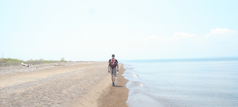
And then we’re led south along the eastern shore. I hear waves lapping against the sandy beach from my place among the trees. I step down into the sand and it seems for all the world like a freshwater sea; blue from the shore to the horizon and up the dome of the sky.
We cross the peninsula through the forest and come out on the western bank. From here we walk along the water’s edge to a sandy spit that meanders to the very bottom of Canada.
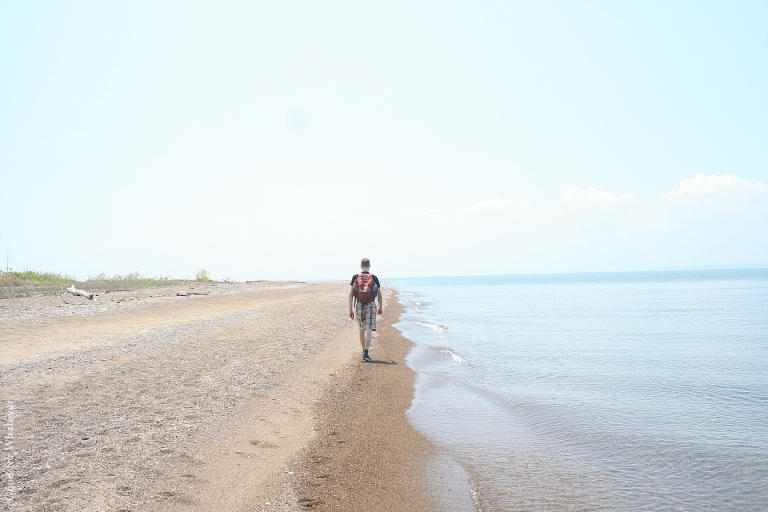
It’s like a dream: Aimless, languorous, a wandering tawny thread of sand and shells. There’s emotion – a swirl of curiosity, excitement, contentment – and sensation abounds; cool wind through my fingers, azure sky lit up by the firey white sun, the smell of fresh water and summer, a clamour of lake birds and the rush of the waves. Those same waves push the sand and shells that, in many spots, struggle to break the surface of the lake.
I’m sure that, when I return some day, this will not be the same; like a river, the elements will reshape this place continuously. Even now, and like a dream, its edges are indistinct. Waves rush in, impossibly, from both the east and the west. When they are high and heavy they crowd us in from either side, sometimes leaving us with only a little patch of sand to stand on, the lake licking at our feet; when they are low and light, the way south opens up.
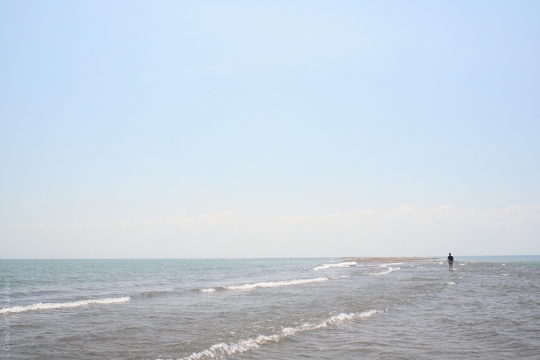
The dreamy evanescence intensifies as we reach the end.
It’s early and we’re the only people here. To the north is a nation of thirty five million people and many millions of square kilometres that stretches to the northernmost places on earth. Here, in the warmth of the bottom of the nation the two of us are accompanied by flights of birds; east, south, and west, luminous waves are shot through by the vanishing path we’re treading.
When we reach the end we see no continent south of us, only smudges on the horizon that are probably islands. It’s as though the world trails off into water, each hint of land an afterthought, a memory of what’s behind us.
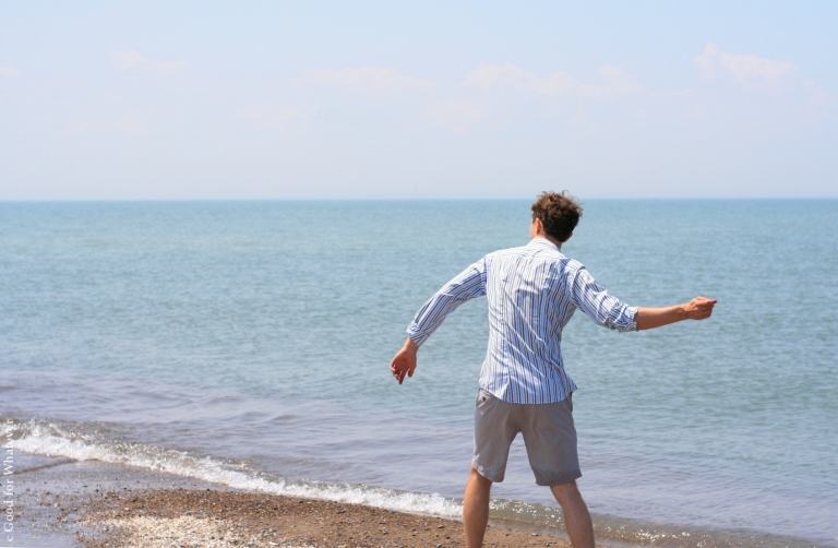
We stand together here, at the bottom of Canada. Feet chill in the sandy blue water, or roast on the sand. We skip stones on the waves.
We interweave our fingers as we step off the land.
Our hands now a bridge between islands adrift in endless azure.
Like what you read? Check out more below, and don’t forget to follow Good For Whatever on Instagram and Facebook.

So beautifully written…glad you enjoyed Pelee as much as I do! It is a special place, isn’t it?
LikeLiked by 1 person
Thank you! Yes, it’s a fantastic place. I’d go back in a heartbeat.
LikeLike
Such a well written article about Pelee Island. Are you aware of The Mission Hall Project?
My daughter has made it her responsibility to save what can be saved of the building.
If your interested in reading about it go to http://www.themissionhallproject.weebly.com
LikeLiked by 1 person
Pelee is my home, I was born and raised there. In fact, my family is the most Southern family in all of Canada! We are located at Fish Point.
LikeLiked by 1 person
Lucky you! It’s an incredible place.
LikeLike